Recreation Sites
---------------------------------------------------------------------------
Site Name:
Rathmichael Wood
National Grid Reference
O 238 216 Understanding grid references
Ordnance Survey Ireland Discovery Series:
50
Location
2.5 km west of Shankill off Ferndale Road.
How do I get there?
From the city centre, head out N11 towards Bray. Take the Shankill exit just before the M11. head in towards Shankill and turn right at Stonebridge Road. Turn left at the roundabout and cross the M50. Go straight through the next roundabout passing Rathmichael church on the right hand side. There is a laneway on the right hand side beside the entrance to Castlegate. The trail starts at the top of this laneway but there is no parking here.
Parking Info:
There are a small car-park at the entrance to Rathmichael Wood on Puck's Castle lane.
Toilets: none on this site.
Features:
- National Waymarked Ways Trail Head (Dublin Mountains Way)
- Walking Trails
- Viewing Points
- Waymarked Trails
- Historic features (rath and stone cross)
Activities:
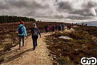
- Walking/Hiking
Site Description
Rathmichael Wood comprises a mixture of coniferous and broadleaved woodland, scrub and acid grassland. These provide food and cover for a variety of wildlife including birds and insects, such as bumblebees and butterflies. Several mammal species use the cover of the woods including the red fox and pygmy shrew. The non-native Sika deer is also a regular visitor to the woodland.
The remains of a rath or hillfort situated on the hilltop of Rathmichael overlooking Shankill, are just discernable. There are splendid views from the site. The rath must have been an important defended settlement in its day, and possibly a political centre of a local wealthy chieftain. On the lane up to Rathmichael Wood from Ferndale Road is a 12th century Fassore cross boundary marker. The cross marked the entance to Rathmichael old church just north east of Rathmichael Woods. It is a short granite cross, with a simple crucifixion scene, a typical wheel-shaped head with short projecting arms, depicted in high relief. It is unusual that the crucifixion scene is on both faces.
Walking Trail(s)
Rathmichael Walk is a short looped walk through the woodland. On reaching the hill fort site the walker is rewarded with splendid views, northwards over Dublin bay, eastwards towards Killiney and Dalkey and southwards to Bray head and the Little Sugar Loaf. This is a looped walk of 1.7km and will take approximately 30 minutes. It is moderate walk with 40 metres of climb. The trail is waymarked green.
A section of the Dublin Mountains Way passes along here. It is waymarked yellow. For more details on this route see Dublin Mountains Way page.
- Recreation
- Archaeology
Recreation Sites in the Dublin Mountains
- 5. Kilmashogue
- 6. Ticknock
- 7. Carrickgollogan
- 8. Barnaslingan
Archaeology Sites in the Dublin Mountains
- 1. Slievethoul
- 2. Lugg Woods
- 3. Seahan
- 4. Hell Fire Club
- 5. Massy's Wood
- 6. Tibradden
- 7. Kilmashogue
- 8. Ticknock
- 9. Ballyedmonduff
- 10. Rathmichael Wood