Recreation Sites
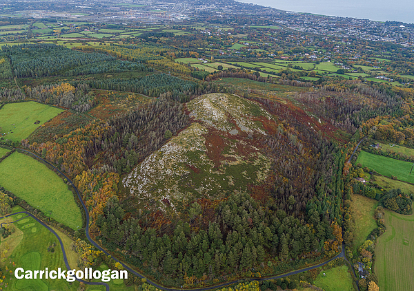
Carrickgollogan
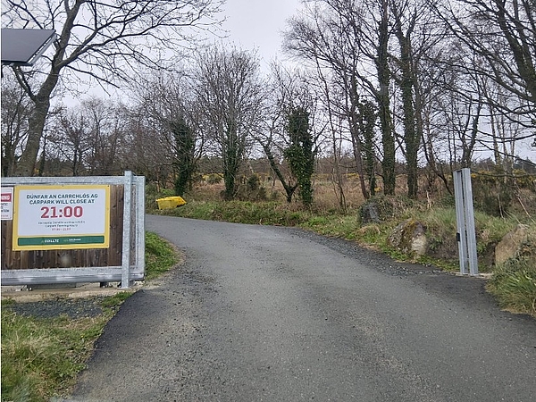
Carpark Opening Hours 07:00-21:00 from 26th March 2026
Site Description
Carrickgollogan Wood, located in the south east corner of Co. Dublin comprises around 85ha (210acres) of mixed woodland including Lodgepole pine, Noble fir, Japanese larch, Lawson cypress, Scots pine, Birch and Beech. In addition furze and heather can be found on unplanted areas/ditches. The trees and other flora provide habitat for badgers, rabbits and a variety of birds.
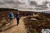
There are about 8km of forest roads at Carrickgollogan which provide a variety of walks. Two of the main attractions are the viewing rock at Carrickgollogan hill to the south of the property and the now disused lead mine chimney at the northern boundary. Lead mining and smelting took place at the Ballycorus lead mine in the early 19th Century and continued until it was closed in the 1920s.
No trip to Carrickgollogan would be complete however without visiting the viewing rock. It is worth the short climb up a moderately sloped footpath to the exposed rock outcrop where you will discover one of the most spectacular views of south Dublin and north Wicklow.
Other features to be found in and around the woods are a Dolmen, the site of a Rath and a memorial to Nathaniel Alcock (1819 - 1904) erected by his daughters in 1914. To find this memorial continue on past the car park to the junction of Murphy's Lane and Ballyman Lane. At the junction there is an ESB pole. Enter the woods at this point and follow the path up the hill for approx 40m. There you will find a stone plaque embedded in a large rock with the inscription:
"To the Memory of One who Worshipped Here
Doctor Nathaniel Alcock Died April 4 1904 in His 85th Year
-A Wise Man is Never so busy as in the Solitary Contemplation of God
And the Worship of Nature - Seneca.
Erected by his Two Friends"
Site Features
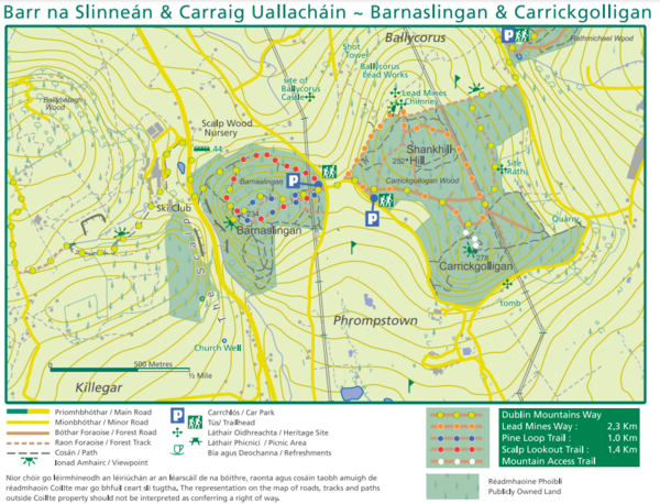
Carrickgollogan Trails
Lead Mines Way: a 2.3 km looped walk starting from the car-park. An easy walk that should take approximately 40 minutes to complete. This trail is way-marked with Orange way marker discs in both directions.
Mountain Access Trail: a short spur route off the Lead Mines Way and Dublin Mountains Way which leads to the summit of Carrickgollogan (278m). On a clear day there is an amazing 360o view from the summit.
Dublin Mountains Way: the Dublin Mountains Way (42.6km) long distance way-marked route travels through Carrickgollogan enroute between Shankill and Tallaght.
Skywalkers by Méadhbh O'Connor
Sky Walkers invites you to take a walk in the forests of Dún Laoghaire-Rathdown, stopping at key sites to listen and take a private moment to reflect. It features six meditative poems written and recorded by the artist Méadhbh O'Connor. The poems are set over ambient soundscapes.
Two of pieces, Carrickgollogan and the Lead Mines of Ballychorus are set in Carrickgollogan, and tell different stories of this wonderful place. The poems can be listened to anywhere but they take on a special meaning if heard while walking or resting in the woodland.
Nature and Place is a new series of temporary works, taking inspiration from the forests of Ticknock, Tibradden, Barnaslingan, Carrickgollogan, Kilmashogue and Ballyedmonduff. The selected artists were awarded funding by dlr Arts Office to develop the first three projects between December 2023 and March 2024. Supported by Coillte and the Dublin Mountains Partnership.
Location
Approx 2.5km south of Kilternan village on the Dublin/Wicklow border.
National Grid Reference: O 225 205 Understanding grid references
Ordnance Survey Ireland Discovery Series: 50
How do I get there on foot?
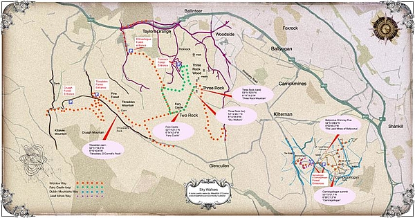
From Shankill it is an approximately 4.5km walk to Carrickgollogan on the Dublin Mountains Way. The Dublin Mountains Way is a 42.6km long distance way-marked route which travels through Carrickgollogan enroute between Shankill and Tallaght.
From Kilternan village there is a foot-path as far as Barnaslingan Wood along the Enniskerry Road. From Barnaslingan it is a 2km walk to Carrickgollogan along the Dublin Mountains Way.
How do I get there on public transport?
The closest bus stop to Carrickgollogan is on the Enniskerry road, an approximately 2km walk, see Walking Trail Map. Dublin Bus Route 44 serves Bus Stop No. 4852 (The Scalp (Butlers) Enniskerry Road Towards Enniskerry and Bus Stop No. 4121, The Scalp Wood Enniskerry Road Towards DCU, see Transport For Ireland's Journey Planner for further information and route planning.
How do I get there by car?
Carrickgollogan is located 2.6km south of Kilternan village in south county Dublin. Drive south on the M50 from Dublin and take the exit at Junction 15. Follow the signs for Kilternan/Kiltiernan village. At the top of the hill turn left. Drive past the garage (Ambrose Glass Motors) which is on your left, go through the next junction and then take the left turn on to Barnaslingan lane. Follow this road for 1.9km and then turn left opposite the entrance to the car park at Barnaslingan wood. The car park for Carrickgollogan is approx 300m up this road.
Parking Information
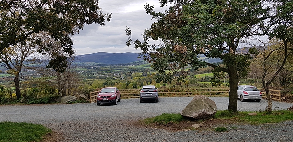
Car spaces: 20
Opening Hours
March 26th to October (summertime): 07:00 to 21:00
November to March (winter-time) : 07:00 to 17:00
Note: When Met Eireann forecast snow/ice condition warnings are in place the car-park may be closed at short notice. In a Met Eireann 'Red' Wind warning, you should not enter any forest area. Updates on car-park and recreation site closures will be posted on the News page.
Coillte's Recreational Sites
For more information on all http://www.coillte.ie/our-forests/explore/
Recreation sites which you can access from here are: Barnaslingan
- Recreation
- Archaeology
Recreation Sites in the Dublin Mountains
- 5. Kilmashogue
- 6. Ticknock
- 7. Carrickgollogan
- 8. Barnaslingan
Archaeology Sites in the Dublin Mountains
- 1. Slievethoul
- 2. Lugg Woods
- 3. Seahan
- 4. Hell Fire Club
- 5. Massy's Wood
- 6. Tibradden
- 7. Kilmashogue
- 8. Ticknock
- 9. Ballyedmonduff
- 10. Rathmichael Wood